El Tigre, Mayan Archeological Site
Spanish “Tiger”
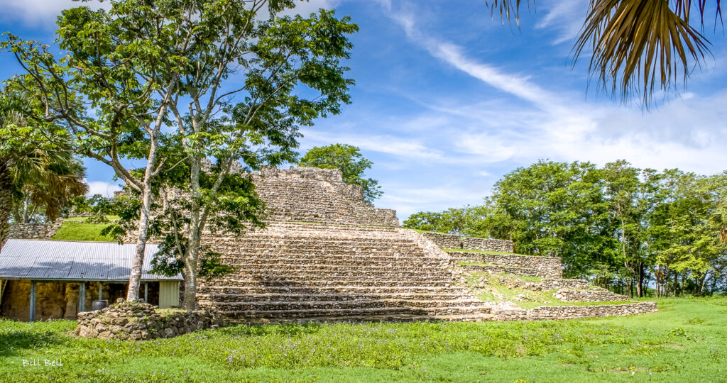
(Also known as Itzamkanac) El Tigre, Mayan Archeological Site
Home of the Snake Lizard
Itzam / lizard, ka / snake, na / home, yak /place
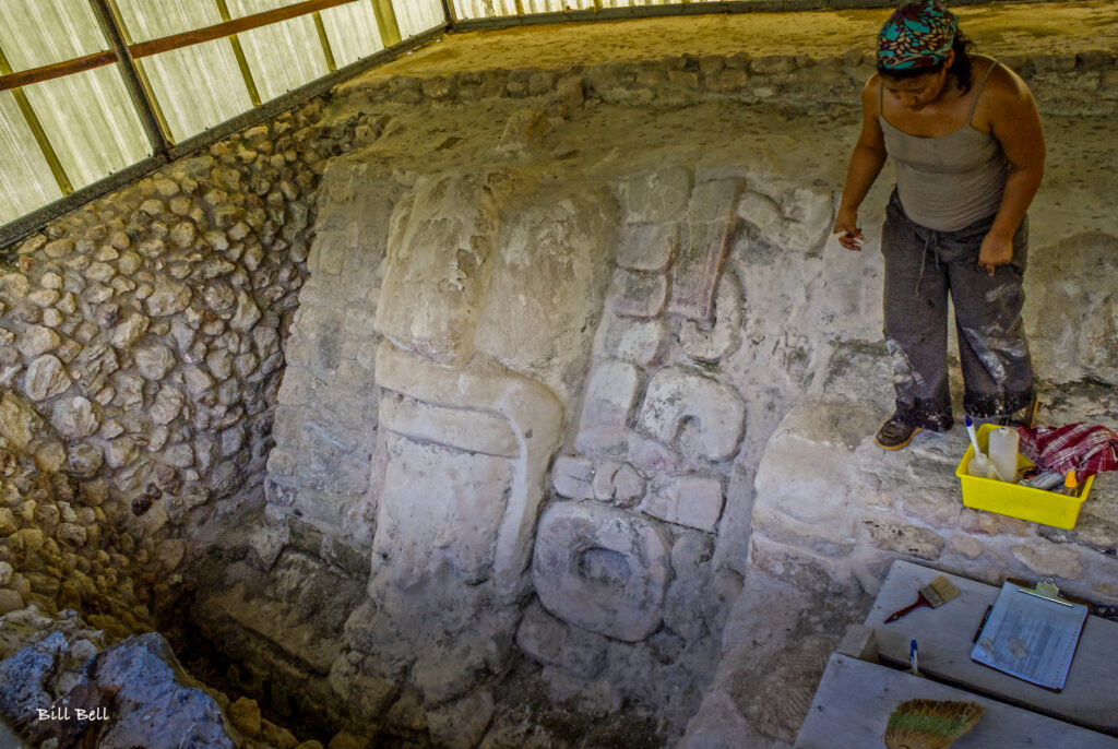
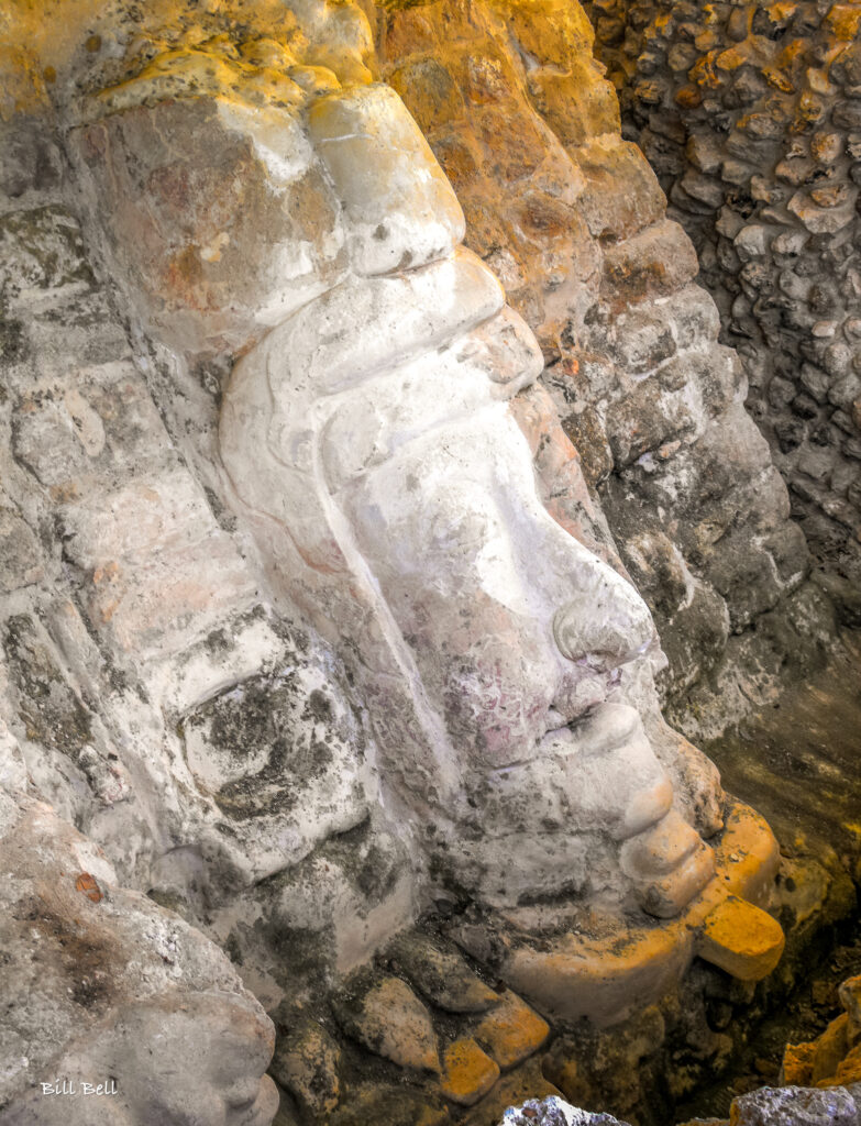
El Tigre/Itzamkanac is a Chontal Maya archaeological zone located within the Candelaria river basin in the south of Campeche. El Tigre is the name of the town/ejido in which the site is located. Itzamkanac, “Place of the Iguana/Crocodile House” in Chontal Maya, was the original name of the site. It has a lengthy history, and was the regional capital of the Acalanes province.
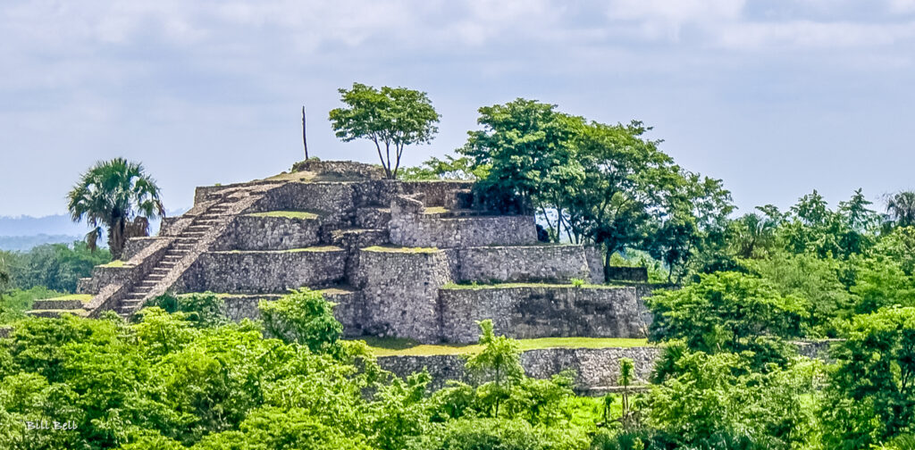
The site is situated upon a hill overlooking the banks of the Candelaria River. The river is about 240 miles/400 km in length, and its tributaries connect both the Peten region of Guatemala to the south, and Calakmul to the east. which in turn flow down to the Terminos Lagoon and Gulf of Mexico. It was a very important trade and communication route.
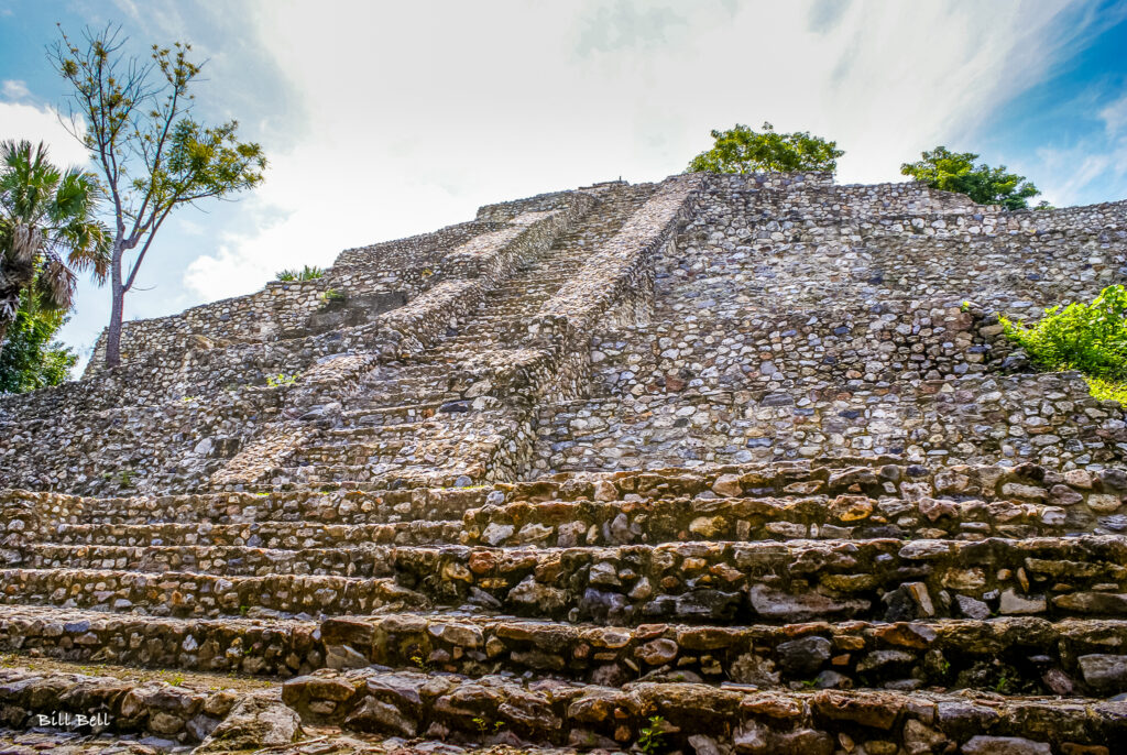
There are two main plazas that house 4 large structures, a ball court, and incorporates 13 altars and 3 plain stelae. Several smaller masonry structures are arranged around the plazas atop raised platforms. The structures themselves exhibit Peten, Rio Bec, and Post Classic architectural styles. Raised agricultural fields have been documented along the banks of the river. The population at its peak has been estimated at 10,000, a fairly large city.
Itzamkanac is not an easy site to reach, and involves numerous turnoffs. From Campeche travel south on Highway 180 to Champoton. At the south end of town take the road south to Escarcega. Stop for lunch or snacks here. Pick up Highway 186 west out of town for about 1 mile/1.6 km to the well-marked turnoff to Candelaria. Once in Candelaria look for signage to Highway 221 south. Follow this road and take the left fork about 6.5 miles/10.6 km out of town. Continue on about 8.75 miles/14km to an east turnoff towards Monclova. Before reaching this town look for signage for a turnoff north to El Tigre and the site. The site can also be reached by boat from Candelaria.
HOURS
Open Daily from 8 am to 5 pm. There is a watchman at the gate who will charge you the standard fee & extra for video cameras.
Free on Sundays for nationals and Mexican residents.
Allow at least 2 hours, especially if you like to climb.
RECOMMENDATIONS
You can stroll safely undisturbed throughout the site – often you will be the only ones there. Take good shoes as there is plenty of climbing and walking. Take a fair amount memory and batteries for your photographs.
As this is site is in a somewhat remote area, take a large bottle of water and insect repellant. There are no restaurants or food vendors. Dress according to the season you are visiting.
GETTING THERE
GPS – N16.07.19 Wo90.50.12
Drive from Villahermosa:
DO NOT FOLLOW THE GIA ROJI MAP. IT IS WRONG.
Take Highway 186 southeast past the Palenque turnoff to KM 232. Make a right hand turn towards Candelaria and El Tigre.
Drive straight through Candelaria to a small town called Reforma. Keep left towards signs to El Tigre. Approx 30 more KMs.
We have had unconfirmed reports that you can hire fishermen in Candelaria to take you to the site by boat.